Imagine walking down Merton Road towards the sea in 1850. Bootle is still a village, the docks have only just begun edging northwards, and somewhere along the shoreline, stands a castle.
Yes, a castle.
Bootle Castle, also known as Miller’s Castle, was built in 1824 by William Miller, a wealthy businessman and solicitor who decided that what his coastal villa really needed was a rather grand castle-like appearance. It stood close to the shoreline during a period when Bootle was becoming a popular seaside resort, long before the docks would come to dominate the waterfront.
The Bootle of this period would have been almost unrecognisable compared with the town we know today. The original village was centred around the junction of Merton Road and Litherland Road, with Merton Road running downhill towards the sea.
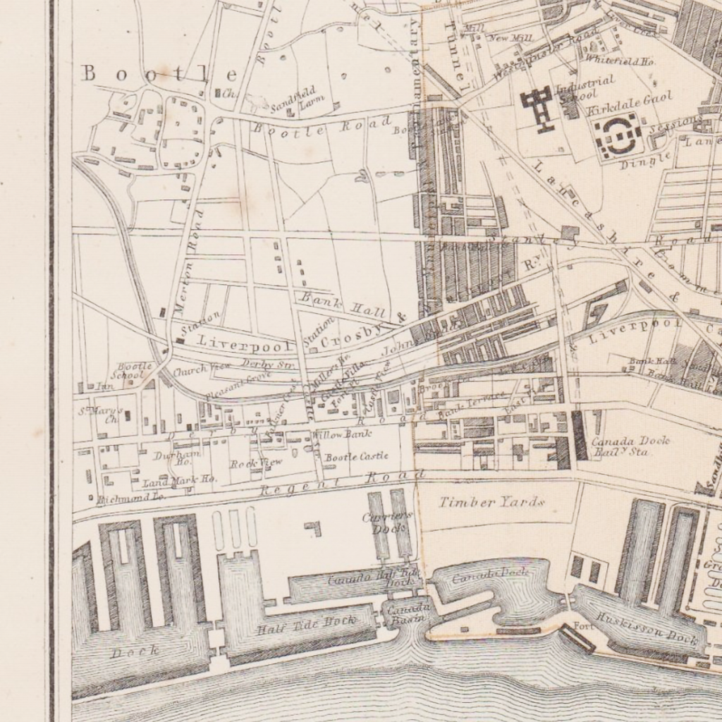
On the 1851 First Edition Ordnance Survey map, Bootle appears as a relatively small settlement surrounded by open land. The Bootle Water Works was already there, while the Leeds and Liverpool Canal and railway lines passed nearby. The docks had begun creeping northwards, but in 1851 only a handful had reached this far.
Along the waterfront, buildings were beginning to form a thick strip between Liverpool Road, now Seaforth Road, and Bankfield Street in Kirkdale, with hotels and public houses appearing among them. Bootle Castle stood just north of the northernmost dock at the time, Canada Half Tide Dock, while St Mary’s Church could be seen in the area that is now Church Gardens cemetery.
For a little while, the village sat between two very different worlds. People came to Bootle Bay for the seaside, while the expanding transport network and Liverpool’s growing industries were steadily drawing the area into the orbit of the docks. New roads were being laid out across the fields, some with names that still survive today, including Merton and Balliol Road.
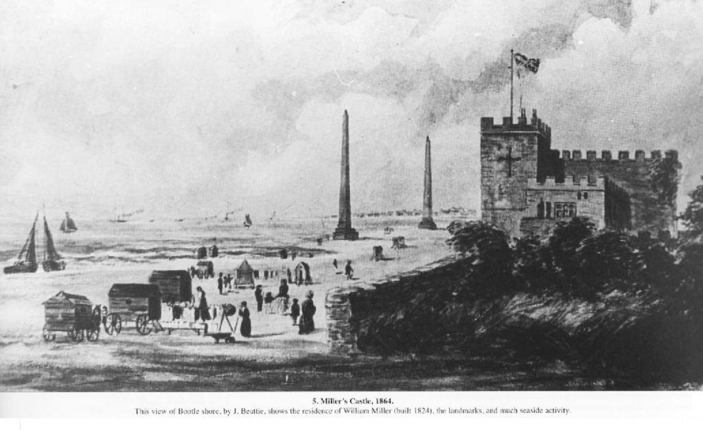
In 1855, thousands of people were reportedly visiting Bootle Bay. But the seaside resort had only a short future ahead of it. During the 1860s, the expansion of Liverpool’s docks accelerated. Warehouses and houses spread across the area, industry took hold, and Bootle’s identity began shifting from coastal resort to busy industrial town. The beach that had attracted visitors was increasingly surrounded by the machinery of a working port.
Miller’s Castle did not survive the transformation. It was demolished in the 1860s to make way for the expanding docks, with much of the original site later disappearing beneath the excavation of Brockle Bank Dock.
The castle was gone, but William Miller’s name remained. Miller’s Bridge was named in his honour, leaving a small reminder of the man who had once built himself a castle beside Bootle’s shoreline.
By the beginning of the 20th century, the transformation was complete. Bootle had become densely populated, with rows of houses packed around the docks and a workforce living close enough to walk to work. Railways, the canal and the port had brought employment and industry, turning what had once been a seaside village into an important industrial centre.
Today, it takes a little imagination to picture the earlier Bootle. The castle has disappeared, the shoreline has been reshaped, and the resort that once drew thousands of visitors has long since vanished.
But look at a road name like Miller’s Bridge, and there is still a faint clue to what came before, a subtle nod to Bootle’s castle by the sea.